The Null Device
Posts matching tags 'geodata'
2012/3/8
In other recent news, Apple launched the latest gadget yesterday, to much-anticipated adulation. There were few surprises in the overt details: the retina display showed up as everyone predicted, and the CPU and camera were also bumped up; oh, and it does LTE, which explains the enlarged battery.
The launch included a presentation demonstrating the new iPad and some new apps for it. Buried within the demonstration of a photo editing package was a bombshell: a fragment of a screen, seen briefly, showed a street map which looked distinctly unlike Google Maps (the mapping system used by iOS since the first iPhone), suggesting that Apple are about to move away from Google Maps to a different platform. Such a move wasn't entirely unanticipated; relations between Apple and Google have been icy recently, so it was only a matter of time until Apple moved to a different mapping system; Apple's acquisition of several mapping-related companies, which promptly disappeared beyond the Cupertino event horizon, suggested that Apple would roll its own system. The only questions were when and what form would it take.
More clues emerged when the iPhoto app became available: (examination of internet traffic from iPhoto revealed that the map tiles were being loaded from a server named gsp2.apple.com, and soon, someone rigged up an unofficial web-based map viewer using the tiles. Finally, it was revealed that Apple are using data from OpenStreetMap for their maps, though rolling their own tiles. The service seems to be in its early stages so far; the resolution stops a few zoom levels short of street-map level and the data they're using is based on a slightly old snapshot of OpenStreetMap, though it's still pretty big news.
Apple's move to OpenStreetMap is the latest in a wave of defections from the once-ubiquitous Google Maps (FourSquare moved a few weeks ago and other sites have been moving to it, propelled by the carrot of OpenStreetMap's high-quality (and rich) data set and the stick of Google moving more aggressively to monetise their maps. As for other mapping services, they don't seem to be getting much of the action; Microsoft's Bing has Facebook, probably because Microsoft own 1% of Facebook, and Flickr still uses Yahoo!'s own mapping system. However, neither looks set to steal the crown from Google, as there isn't likely to be a crown to steal soon.
It looks like online geodata may have approached the tipping point that electronic encyclopædias reached with Wikipedia and UNIX on commodity hardware (remember commercial PC UNIX?) reached with Linux: the point beyond which it makes no economic or business sense to go it alone, and where proprietary products are an evolutionary dead end.
It'll be interesting what the UK's Ordnance Survey, for long the dog in the manger of geodata, will make of the new shifting environment it finds itself in.
2012/1/21
Meanwhile, it looks like OpenStreetMap may be on the verge of doing to commercial, closed mapping services (such as Google Maps and Microsoft's Bing Maps) what Wikipedia did to Encyclopaedia Britannica's previously unassailable position. Wikipedia's David Gerard suggests that mapping and geodata may be the next dinosaur to sink into the tarpit; now that Google are moving to squeeze more revenue out of their popular Maps product, some businesses are finding that it makes more sense to use OpenStreetMap, and invest in improving it where it falls short:
I think that someone at Google got their pricing wrong by an order of magnitude. Large companies might be willing to pay that kind of licenses, but this is not the CMS market in 1998, where people would pay half a million for a Vignette license and another million for Oracle. There are so many open source options out there that the value of proprietary solutions has come down dramatically.And no less a publication than Wired has an article on switching to OpenStreetMap:
Since Nestoria made the switch to OSM, he says, the company has received almost no complaints about the change in its map background. Some users in remote areas of Europe, he adds, have even praised the new interface for the details it provides on their little towns. What’s more, in making the switch to OSM, Nestoria gained some flexibility it never had with Google.Among the takeaways from the article: old-school mapping company MapQuest (remember them? they were around in the ancient NCSA Mosaic days when slideable maps didn't exist, and you had to click on one of eight arrows to move to the next square), once vanquished by Google Maps, having been reborn as a frontend and contributor to OSM. Which suggests that OSM has achieved the sort of critical mass that going it alone to compete with the dominant vendors makes as little sense as Google's in-house Wikipedia competitor Knol (which they euthanased a year or two ago).
Google may not be taking the market for their mapping product being commodified lying down: there are reports of someone polluting OpenStreetMap data, coming from the same IP addresses belonging to a Google unit in India who were earlier caught trying to rip off a Kenyan crowdsourced business directory. (Given that Google have in the past contributed to OpenStreetMap, this seems somewhat out of character; unless the gloves have come off and "don't be evil" has been declared a non-core promise.)
2010/6/21
And the first dividends of Transport For London's opening of its data to the public have started flowing in; a chap named Matthew Somerville has created a real-time map of trains on the London Underground, displayed on a Google Map. The source code is available here. Somerville also has a similar map for National Rail trains, though, due to the more limited data published by National Rail, it can only show trains due to arrive at one of several stations. (Let's hope that National Rail see the benefits of opening their data soon.)
2010/6/16
Some good news from London: Transport For London, who run the city's public transport networks, have announced that they will be opening access to all their data by the end of June. The data will include station locations, bus routes and timetable information, and will be free from restrictions for commercial or noncommercial use.
The data will be hosted at the London DataStore, a site set up to give the public access to data from public-sector organisations serving London. A few sets are already up, as well as a beta API which returns the locations of Tube trains heading for a specific station. Which could probably be worked into a mobile app to tell you when to start walking to the station. If they had something like this giving the positions and estimated arrival times of buses (whose travel times are considerably more chaotic than those of trains, and which often run less frequently, especially at night), that would be even more useful. (Some approximation of this facility exists in the LED displays, which are installed at some bus stops and sometimes are operational; a XML feed and a mobile web app would probably be a more cost-effective way of getting this information into the hands of commuters.)
Another thing that would be useful would be an API for the Transport for London Journey Planner; being able to ping a URL, passing an some postcodes or station names, a departure/arrival time and some other constraints, and get back, at your option, a maximum journey time or a list of suitable journeys, in XML or JSON format, would be useful in a lot of applications, from device- or application-specific front ends (i.e., a "take me home from here" mobile app) to ways of calculating the "inconvenience distance" between two points by counting travel time and changes (i.e.,in terms of travel convenience, Stratford is closer to Notting Hill than Stoke Newington, despite being further in geographical terms, as it's a straight trip on the Central Line).
2010/4/1
The Ordnance Survey, long the dog in the manger of taxpayer-funded geodata, is setting its data free. From tomorrow, data including 1:10,000-scale maps and the coordinates of UK postcodes will be free for both personal and commercial use. (Some maps, such as the Explorer and Landranger maps, will remain commercial.)
OS is government-owned but self-funding through the sale of licences to use its maps. It had revenues of about £117m in 2009, of which roughly half came from the public sector, and provided a dividend of about £5m to the Treasury. The new arrangements are expected to cost about £20m in forgone revenues – which the government anticipates will be made up through increased tax revenues. The Treasury has agreed to fund the difference.The Ordnance Survey's Open Data site is here; may a million mashups bloom.
2009/11/18
Some good news on the free data front: the New Labour government, in its desperate attempts to claw back the status of lesser evil, has vowed to make all Ordnance Survey maps freely available, ending the OS's practice of licensing said data for exorbitant fees and under restrictive terms, and bringing Britain into line with the US (where US Geological Survey data is statutorily in the public domain):
The government has been inspired by the success of crime mapping where "data openness" is helping citizens assess the safety of geographical areas.
In the new year Brown intends to publish 2,000 sets of data, possibly including all legislation, as well as road-traffic counts over the past eight years, property prices listed with the stamp-duty yield, motoring offences with types of offence and the numbers, by county, for the top six offences.It is thought that among the data to be freed will be railway and bus timetables, currently being licensed under monopoly rents by privatised companies. (For example, those wanting National Rail timetables on the iPhone, and not wishing to reload the web page and zoom in on form fields every time, have to buy a £4.99 application. There was a free app, written by a user, but its access to the data was blocked by the rightsholders. The National Rail Enquiries application is currently the 10th highest grossing application in the UK App Store, undoubtedly making the publisher, Agant Inc., a mint out of the public.)
The Ordnance Survey are of course keen to protect their revenue streams, and argue that freeing their data would cost the government vast sums; an independent study at Cambridge University, however, showed that the costs of freeing the data (£12m) would be overwhelmingly outweighed by a net gain of £156m. A significant proportion of this would undoubtedly come from the slices of council tax and other funds currently being paid to the Ordnance Survey to license this data:
Local authorities also spend a lot of money getting access to Ordnance Survey. Swindon recently had to pay the OS £38,000 a year to use its addresses and geographical data, even though it had collected much of the data.Of course, the devil is in the details. For all we know, the plan to free the data could be a purely cosmetic gesture comprised of little more than hot air and New Labour spin, offering the "freed" data under such onerous terms as to make it unusable. Though if it does live up to the promise, it will be a bold step in the right direction.
2009/10/3
The British postcode system, one of the things which Britain arguably does better than anyone else, is 50 years old. The system divides the entire UK into alphanumeric postal districts organised in a hierarchy, with the first one or two letters denoting a postal area (typically a city or the environs of one, though London has several). Unlike systems elsewhere (such as the US, Australia, and most of Europe), it doesn't stop at the neighbourhood level, with each 5-to-7-character full postcode denoting a segment of a street. This makes it useful for applications other than addressing mail, such as navigation; as such, you can enter a postcode into Google Maps or a satellite navigation unit and be shown exactly where it refers to.
Unfortunately, though, the database of postcodes and their locations is another victim of the British institutional custom of copyrighting taxpayer-funded databases and licensing them only at great expense and under onerous terms (see also: the Ordnance Survey), effectively restricting them to moneyed corporations. However, there are several unofficial efforts to assemble this data from scratch and release it into the public domain.
2009/7/14
Web interface of the day: A Chinese company has unified isometric pixel art and Google Maps-style draggable maps to make pixelicious city maps.
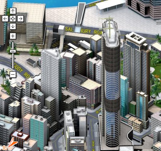
They have a map of Hong Kong in English, and maps of other Chinese cities (Chinese only; Google translation here). Not sure if it's much more useful than a 2D map, but it sure looks pretty.
Now perhaps someone can commission eBoy to do one of Berlin. Or of the internet.
2009/6/23
Blog discovery of the day: The Infrastructurist, which focuses on issues such as transport and urban planning, from a largely, though not entirely, US-centric point of view, and has some interesting stories. Such as a LA Times piece on the Dubai model of urbanism, an Economist piece on the Obama administration's US$500bn transport bill (which includes 50 billion for high-speed rail), a Google Maps gallery of six intriguingly shaped communities, a piece on what to do when neo-Nazis decide to sponsor a US highway (the answer: rename it after a civil rights leader), and a gallery of grand railway stations in America, all now long-since demolished.
2009/6/2
Google Earth scores another scalp; thanks to its satellite imagery, a group of amateurs has been able to build up a comprehensive picture of North Korea, thwarting the hermit kingdom's hermetic borders. The picture is, as one might expect, not a pretty one:
Among the most notable findings is the site of mass graves created in the 1990s following a famine that the UN estimates killed about 2 million people. "Graves cover entire mountains," Melvin said.
The palaces housing dictator Kim Jong Il and his inner circle, clearly shown on the maps, contain Olympic-size swimming pools with giant waterslides and golf courses.The data is available as a Google Earth layer, peppered with detailed landmarks, from the project's web site. While Google Earth was crucial to it, other information sources, from sketches by defectors and escapees to the North Korean state press's own carefully circumscribed reports of the
The authors of the data have notified North Korean embassies about it but, for some reason, received no response.
Meanwhile, OpenStreetMap has actual maps of North Korea (sometimes even with labels); here, for example, is central Pyongyang.
2008/11/20
Britain's local councils and government departments have started to embrace web-based mapping technology, and using systems like Google Maps to display geographical information, from the locations of public toilets and recycling facilities to crime statistics. Of course, the Ordnance Survey, that troll under the bridge of UK geodata, doesn't like this one bit, and has started making threatening noises at local councils, warning them that they are prohibited from putting any data that has ever touched Ordnance Survey data on Google Maps. Of course, they might be willing to take a more agreeable line if the councils (and consequently, the taxpayers) paid them more to license the data (which was gathered using taxpayers' money, and subsequently privatised in line with Thatcherite-Blairite ideology) for web-based maps; in the meantime, they have offered the councils their own Google Maps substitute, which comes with its own poisonous licensing conditions:
The move also seems to block most of the winners of Cabinet Office's recently completed £80,000 Show Us A Better Way competition to find innovative ways to use government-held data. The winner of that competition, a site called Can I Recycle It?, would rely on locating local recycling centres - which OS could argue has been derived from its maps if a council keeps them with any sort of geographical referencing. The same would be true of another winner, Loofinder, which aims to make locations of public toilets available in a map online, just as described above.
Although OS issued a press release congratulating the competition winners and offering them "full access" to its Google Maps-like OpenSpace system - which has similar programmability - the OpenSpace licence limits the number of viewings allowed per day, and bans any use by business, central or local government. Furthermore, OS claims ownership of any data plotted on an OpenSpace-derived map. And the use of derived data would break its licence with authorities.However, this time this may have consequences the OS weren't anticipating; some councils are now making noises about buying a few GPS units and paying people to go around, collect coordinates of boundaries and facilities, and plug them into OpenStreetMap, essentially telling the Ordnance Survey to go jump.
2008/8/29
Britain's most senior cartographer has railed against electronic maps, arguing that they obliterate the rich geography of Britain, reducing an ancient landscape filled with history to a set of roads:
Churches, cathedrals, stately homes, battlefields, ancient woodlands, rivers, eccentric landmarks and many more features which make up the tapestry of the British landscape are not being represented in online maps, which focus on merely providing driving directions, said Mary Spence, President of the British Cartographical Society.
"Corporate cartographers are demolishing thousands of years of history, not to mention Britain's geography, at a stroke, by not including them on maps," she said. "We're in danger of losing what makes maps unique; giving us a feel for a place."While Spence's complaint seems superficially plausible, it misses the forest for the trees (no pun intended), focussing on the specifics of the implementations of a yet novel technology and ignoring the momentum that is driving progress forward. It's true that, when you look at a map in Google Maps or on a satnav unit, it, by default, shows you a minimalistic, functional map, consisting of sparse lines rendered in brightly coloured pixels. However, it is also true that there is more than that beneath the surface. Google Earth, Google Maps' big brother, renders the globe with a panoply of user-selectable layers, from the standard geographical landmarks (roads, railways, cities) to links to geotagged Wikipedia pages and photographs (albeit on some weird service nobody uses because everyone's on rival Yahoo!'s Flickr). Google Earth itself allows users to draw their own layers and send links to them. And OpenStreetMap takes it one step further, doing for mapping what Wikipedia did for textual reference works; if you find that your map of Gloucestershire is missing Tewkesbury Abbey or your map of Cental Asia got the Aral Sea wrong, you can correct it. And if you live somewhere where there is no Google Maps (and, indeed, no Ordnance Survey), you can map it yourself (or get some friends together to map it; or petition the local government/chamber of commerce to buy a few GPS units and pay some people to drive around with them, assembling a map). This has resulted in excellent maps of places Google hasn't reached yet, like, say, Reykjavík, Buenos Aires and much of Africa.
Making maps is only half of the equation; it's when one considers what can be done with all the mapping data that things become really exciting. Now that mobile data terminals (which people often still refer to as "phones"), with wireless internet connections and GPS receivers, are becoming commonplace, these soulless, history-levelling map databases are transformed into a living dialogue with and about one's surroundings. Already mobile phones which can help you find various amenities and businesses near where you are are being advertised. It is trivial to imagine this extended from merely telling you where the nearest public toilet is or how to get home from where you are into less mundane matters. Press one button, it points out historical facts about your location, with links to Wikipedia pages; press another one, and it scours online listings and tells you what's happening nearby. Follow any link to flesh out the picture as deeply as you have time for.
Spence's argument reminds me of a lot of the beliefs about computers from the 1950s, when computers were expensive, hulking beasts which were programmed laboriously using punched cards and rudimentary languages like FORTRAN and COBOL. It was too easy to extrapolate the status quo, the baby steps of a new technology, in a straight line and see a future of centralised hegemony and soul-crushing tedium, where the world is reorganised around the needs of these primitive, inflexible machines. Of course, that world never came about, as the machines evolved rapidly; instead of being marshalled into centrally computerised routines, we got iPods, blogs and Nintendo Wiis. To suggest that computerised maps will reduce our shared psychogeography to a collection of colour-coded roads is similarly absurd.
2008/7/23
A few years ago, a few geeks in the UK, displeased with the Ordnance Survey's hoarding of taxpayer-funded mapping data, decided to do something about it, and so OpenStreetMap was born. Based on the same principle as Wikipedia, it used the power of internet-based grass-roots organisation to allow people to make their own maps, walking roads with GPS units, uploading the traces and giving them names. Out-of-copyright vintage maps and donated satellite data, among other things, helped a bit.
As you can imagine, in the early days, it wasn't much to look at. There were networks of roads, though most of them weren't named, and a lot were missing. You could sort of make out where you were, if you knew the place well. The interface was also somewhat slow and clunky, compared to Google Maps (a variation on whose draggable-tiled-map theme it was).
After a year or two, I looked at OpenStreetMap again today, and the story couldn't be more different. Where once was a slow, unusably incomplete tangle of rectilinear spaghetti, now there are street maps, as comprehensive and neatly rendered as Google and Yahoo!'s efforts, animated with a fast, responsive JavaScript interface (nothing you won't be familiar with if you haven't used Google Maps). Scrolling around the UK and zooming in on London brought familiar street plans, albeit in a new rendering. In fact, the (rather nifty) real-estate search mashup Nestoria even have a parallel version of their site which uses OpenStreetMap; the user experience is virtually identical to the main, Google Maps-based one. (For what it's worth, Nestoria uses something called Mapstraction, a browser-side JavaScript library that allows different mapping providers to be used interchangeably, but I digress.)
And as cool as a free-as-in-libre map of Great Britain might be (to one who lives there: pretty cool; your mileage may vary), that's not the extent of it. The OpenStreetMap project's scope is global; the developers created a canvas the size of the Earth's surface, with land masses and the locations of cities filled in, and allowed volunteers to contribute to it, wiki-fashion. Soon, OpenStreetMap had maps for Europe, North America and Australia like the commercial competitors. More interestingly, places which, to the big boys, are terra incognita often show up (in varying degrees) on OpenStreetMap.Some are impressively comprehensive; for example, OSM's maps of Reykjavík (and, indeed, Iceland's second city, Akureyri) and Buenos Aires are as thorough as anything you'd expect from Google, were they to bother. Harare, whilst looking quite sparse, is more detailed than on Google's maps, and the Papua New Guinean capital of Port Moresby seems fairly comprehensively drawn. Even Pyongyang has a surprising amount of detail (though one probably can't blame OpenStreetMap for most of the streets being seemingly unnamed); I imagine that as soon as North Korea allows unrestricted tourism, long before the first McDonalds goes up, tourists will be dragging cached OpenStreetMap tiles on their jailbroken iPhones as they negotiate its broad Stalinist boulevards.
Being based on free data, OpenStreetMap has other advantages over its commercial cousins. Each map comes with an Export tab, which lets you grab the displayed area in a variety of formats, from rendered pixmaps to SVG or PostScript to the actual raw data. With it being under the Creative Commons, you are free to do as you like with the data (subject to a "share alike" proviso if you commercialise it). And with it having the agility of the Wiki age, OpenStreetMap is starting to steal a march on its competitors; for example, it was the first map to show Heathrow Terminal 5 correctly.
Of course, OpenStreetMap is by no means perfect. parts of the world are still uncovered (much of the Russian interior), or only covered with major roads (much of Africa). And their rendering algorithm doesn't seem to do Chinese or Japanese characters, rendering most of China's place names as rows of boxes. (If one is picky, one could request transliterations of foreign character sets; perhaps this could be done as user-selectable layers.) There is no route-finding capability (of the sort that Google Maps has). But all in all, OpenStreetMap is very impressive, and a spectacular success.
2006/11/19
One of the things that Britain does better than anyone else is postcodes; while most countries' postcodes give you an area the size of a suburb or town, the six or seven letters of a Royal Mail postcode give you a segment of a street, with enough information to find the place the code refers to. This allows sites like the Transport for London Journey Planner to tell you exactly how to get from one postcode to another.
There is a problem with this, though; the postcode data is not free, but is owned by Royal Mail, who monetise the hell out of it. If you wish to use the database for your own purposes, doing so will cost you a few thousand pounds a year. (The fact that your taxes may have paid for the system to be drawn up doesn't enter into the argument.)
Anyway, this has gotten up the nose of a number of open-geodata activists, who are doing something about it: they're collecting their own data mapping points to postcodes, and using this to draw up freely usable and distributable maps of postcode areas. Free The Postcode! is aiming to do this at a high level of accuracy, soliciting input from people with GPS receivers; meanwhile, New Popular Edition Maps is using a 1940s-vintage map of England and Wales (Scotland and Northern Ireland may come later) to allow people to click on where their homes are and enter the postcodes. Since this is inherently less accurate (the map is of fairly low resolution, and the process depends on matching shapes of streets), they're only concerned with the prefixes at this stage. The data produced will be released into the public domain.
(via Boing Boing) ¶ 0
2006/11/6
The UK's Ordnance Survey, the government agency which uses taxpayers' funds to create incredibly detailed maps and then licenses them under prohibitive licensing terms and steep fees, seems to be thawing to open access to its data, and is experimenting with a Google Maps-style JavaScript interface, to be named "OpenSpace". Note that if it is released, it will only be for noncommercial use, and the actual data itself won't be made public. I wonder how much this is a result of pressure from OpenStreetMap and other guerilla mappers encroaching on its monopoly.
2006/6/28
A London artist has produced a noise-level map of London, showing where the quiet places in this noisy city are.
(via Boing Boing) ¶ 0
2006/5/4
In Britain, there is little free map data. There is an excellent map of the whole of Britain, assembled by the government's Ordnance Survey, but, in line with Thatcherite-Blairite ideology, which holds that not extracting the maximum profit is a grievious dereliction of duty, this is commercial and expensive. (In contrast, the United States Geographical Survey's maps are in the public domain, the reasoning being that, as they were assembled with public funds, they belong to the public.) A group of mapping geeks and free-culture activists under the banner of OpenStreetMap are working to reverse this by creating their own maps; they have a wiki-like system to which volunteers with GPS units can upload traces of streets they have walked down and such. This weekend, they are having a working bee of sorts, intensively mapping the Isle of Wight. More than 30 volunteers will descend on the island, walking its many paths with GPS units and uploading their traces to the wiki; of course, the more the merrier, so if you have a GPS unit and a belief that information wants to be free.
It is hoped that this project, and the OpenStreetMap project in general, will force a sea change in the ownership of geographical data in the UK, much in the way that the Sanger Institute's human-genome sequencing effort in Cambridge made it unfeasible for Celera Genomics to exercise proprietary control over the human genome.
(via Boing Boing) ¶ 3
2005/11/22
Throughout its existence, the Soviet Union went to great efforts producing extremely accurate maps of the entire world, often containing information omitted from local maps. The information was often gathered by surreptitious means, especially in Western countries. And because the Commies didn't believe in intellectual property and the aggressive monetisation of all possible rights, these maps are now claimed to be in the public domain (though they are currently illegal in the UK, because of alleged copyright violations; the articles linked on the page, however, argue that the maps did not use Ordnance Survey data, though the Ordnance Survey still argues that the maps illegally undermine its monopoly), which could mean that, should digitised versions find their way onto the net, they may prove invaluable to open mapping projects.
And here is a Pravda article mentioning the alarm that occurred in Sweden when they found out that the Russians had better maps of Sweden than they did, and allegations that a lot of the data was gathered by KGB agents posing as the children of Swedish Communists who moved to the USSR in the 1930s and then disappeared in Stalin's purges.
(via bOING bOING) ¶ 3
2005/8/8
Impressive hack of the day: turning a Nintendo DS into a GPS-enabled map viewer, using a GPS unit wired to its serial port and a CompactFlash card full of map tile images purloined from Google Maps.
The use of downloaded Google Maps tiles is interesting; I wonder how long until someone writes a map viewer for PalmOS which uses these, effectively cutting into the market share of programs like Tube (which have limited coverage, and often annoying qualities such as being unable to scroll between map tiles; a pain when you're looking for somewhere just off the map, or in the intersection between two tiles). Then again, Google may be able and/or obliged to use the DMCA against any software which attempts to use its map tiles in this fashion (though I am not a lawyer).
2004/11/18
Last night, I went to Dorkbot). It was a bit of a mixed bag; the presentation on London Free Map (a sort of geospatial Wikipedia, consisting of people with GPS units walking the lengths of streets to build up a GFDL/CC-licensed map of London and break the Ordnance Survey monopoly; connected with OpenStreetMap) was interesting, as were some of the "minidorks", including one by a chap who put a Wacom tablet on a guitar-like mount and used it to make noise with Max/MSP, and one by an American who built a 3D voxel display for Burning Man, using 729 microcontrollers, RGB LEDs and ping-pong balls, and an Ethernet printer server to control them). Others left a bit to be desired; the architecture student who started his with footage of the World Trade Center attack and went on to talk about the acoustics of spaces, sticking microphones into his mouth and filling latex balls with white noise, seemed a bit on the random side, while the presentation about the possibility of a bicycle that folds into an umbrella-sized package had little more than hastily-made Microsoft Paint drawings to it. There was also an intriguing-looking installation on the table, consisting of a brain-shaped set of neon tubes, a red vintage telephone and a Radio Shack speaker box, though the person operating it couldn't make it, and attempts to demonstrate it over the phone proved inconclusive (all it did was flicker, and the mobile phone interference drowned out what the guy at the other end was saying).
2003/6/3
A Canadian company has devised a universal postcode system. With this system, a 10-character code, of the form "W2B00 8P2H0" uniquely denotes an area measuring approximately one square metre anywhere on the earth's surface. The Natural Area Coding System itself is quite simple; each character is a base-30 digit, and the two groups of characters refer to longitude and latitude as fractions of 360 and 180 degrees respectively.
This all sounds like one of those brilliantly original ideas, like Esperanto or Metric Time, which, for all their ingenuity, come up face-first against the brick wall of pragmatism and inertia, people being creatures of habit and all; except for two things: firstly, in the age of GPS, Natural Area Coding System codes will be easier to determine than traditional post codes, as there will be no maps or databases to look up, and also no questions of changing boundaries (as happens from time to time, for example when resident groups or landlords lobby to redraw the boundaries so their properties aren't in Footscray or South-Central LA or somewhere similarly insalubrious). And secondly, Microsoft are backing the idea, and plan to integrate it with their MapPoint map service. (Perhaps they hope that they can use it to lock customers into depending on Microsoft technologies or something? I wonder if it's patented.)
NACS could eventually become a world-wide postcode, replacing legacy postcode systems devised in the pre-GPS era. It would probably happen with shipping/courier firms utilising the codes internally, and businesses which deal with them putting them on their details, and finally postal services phase out the pre-GPS system and adopt this. Of course, if someone detonates an EMP bomb in the high stratosphere and fries all the GPS satellites (or if the Americans stop being our friends), we're all fucked; but if all the satellites disappear, we'd have more important things to worry about.